

“Can anyone, viewing the rose garden at Mattano Park […] believe that only a few years ago a swampy meadow existed here, which was used as a garbage dumping ground and helped breed millions of mosquitoes?” [1]
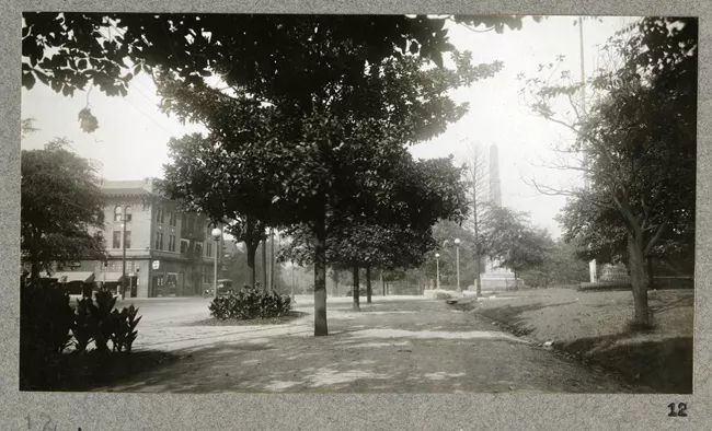
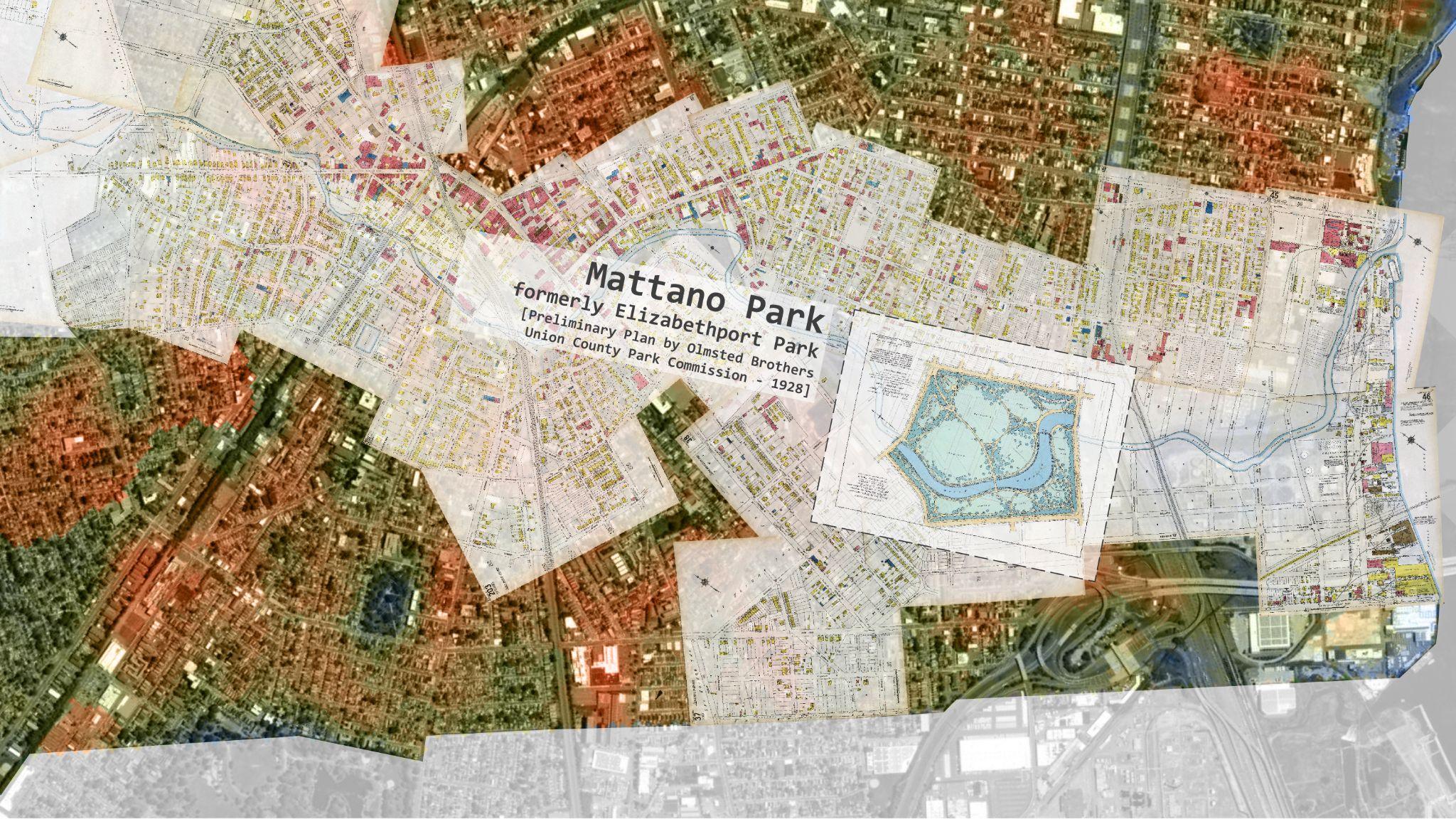
In 1935, Arthur R. Wendell, president of the Union County Park Commission, used this striking contrast to celebrate the opening of Mattano Park in Elizabeth, New Jersey. Once a dumping ground along the infamously polluted Elizabeth River, the site had been transformed by the Olmsted Brothers into an exquisitely designed public landscape [Fig. 1]. For the rapidly growing immigrant population of this port city within the broader New York–New Jersey harbor system, the new park offered a much-needed green refuge.
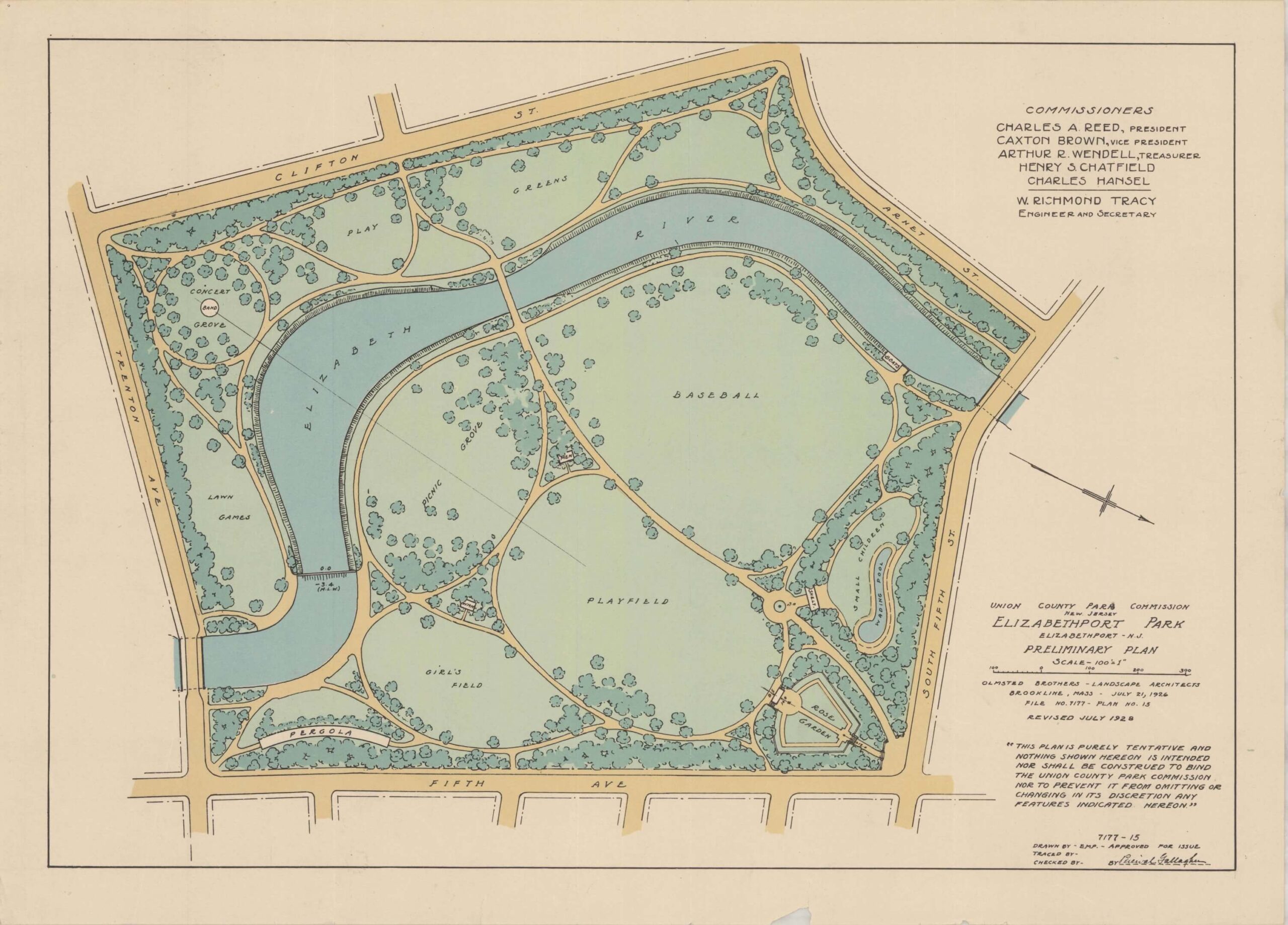
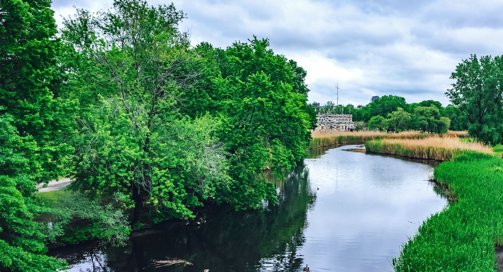
While iconic to Mattano Park, the rose garden was only one element of a much larger landscape vision. The Olmsted Brothers, whose Union County park system would later be described by Olmsted scholar Charles E. Beveridge as “a jewel,” [2] envisioned a generous tree canopy that would buffer the park from the dense industrial city around it while creating shaded groves, open fields, walking paths, and gathering spaces for Elizabeth residents.
Trees were meant to mature alongside the city. Most, however, never did.
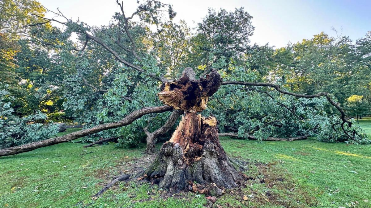
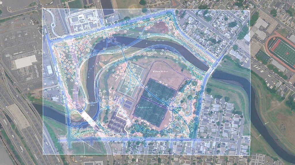
Today, the clearest trace of Mattano Park’s intended urban forest survives in the Olmsted archives. The 1928 plan shows roughly 448 trees east of the Elizabeth River and another 290 to the west. Today, only about 102 trees remain on the eastern side and 35 on the western side. Seen against the present landscape, the discrepancy makes visible an urban forest that largely never came to be, but whose shade and ecological value would be more needed today than ever before [Fig. 2].
Almost a century later, the absence of that planned canopy carries new climate significance. July 2026 was the warmest month on record for the contiguous United States, according to the National Oceanic and Atmospheric Administration.[3] In Elizabeth, temperatures reached 105°F (40.6°C) during an early-July heat wave, in a city where impervious surfaces cover 72.8 percent of the land. These conditions are especially consequential in an urban landscape crossed by the New Jersey Turnpike, partly occupied by Newark Liberty International Airport, and home to the Port Newark–Elizabeth Marine Terminal, with large expanses of pavement and industrial land that absorb and retain heat. What was once conceived primarily as a fundamental element of landscape composition now carries added climate urgency: tree canopy provides shade, lowers surface and air temperatures, filters air pollutants, and can make public space more usable during periods of extreme heat.
The missing trees of Mattano Park tell more than the story of an unfinished Olmsted-designed landscape. They offer a way to ask how the environmental ambitions of an early twentieth-century park system intersect with the needs of Elizabeth today, as the city faces mounting climate pressures. The question also carries social weight. Mattano Park opened in 1935 in a neighborhood shaped largely by Italian and Polish immigrant port workers; today, Latino residents make up roughly two-thirds of Elizabeth’s population, according to the 2020 U.S. Census. The communities have changed, but the underlying question remains strikingly familiar: what quality of green space does a dense working city provide to the people who depend on it, particularly where tree canopy and relief from extreme heat remain limited?
To address this question, a research team at the Rutgers Bloustein School of Planning and Public Policy, in partnership with the local nonprofit Groundwork Elizabeth, is combining archival research with longitudinal social and environmental analysis of the city. The project, titled ReMapping Olmsted, traces the origins of the park system along the Elizabeth River, using digitized Sanborn maps and individual-level 1920 census records to reconstruct the communities living around these landscapes when the Olmsted Brothers received the commission. It then asks how Elizabeth’s changing urban and environmental conditions continue to intersect with this inherited landscape as extreme heat places new pressures on the city.
An Olmsted Vision for Union County
Under New Jersey’s Park Act of 1894, creating a county park system required more than political will. A county first had to reach a population of 200,000 before it could establish a park commission, and acquiring land on a large scale demanded substantial public investment. Essex County crossed that threshold early, creating its commission in 1895 — the first county park commission in the nation — and later turning to the Olmsted Brothers to design a comprehensive system of parks. Union County looked closely at its neighboring reference. In November 1921, voters approved $2.5 million for a new county park system, formally establishing the Union County Park Commission and setting the stage for its own collaboration with the Olmsted Brothers.
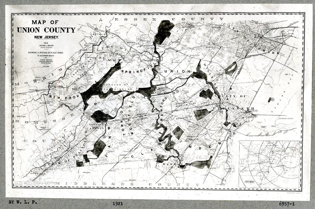
The earliest Union County plan preserved at the Frederick Law Olmsted National Historic Site was drawn directly over a map of the county, connecting 23 parks and green spaces into a continuous system reminiscent of other Olmsted landscapes [Fig. 3]. What made Union County unusual, however, was not simply the ambition of the plan but the extent to which the land needed to realize it was actually secured. As Jeanne Kolva noted in Olmsted Parks in New Jersey (2011), “the Union County system stands as the only instance where the Olmsted Brothers firm was successful in convincing a Park Commission to acquire all the land necessary to establish linked parks.” But land acquisition did not guarantee that the landscape would be built as envisioned. As budgets tightened and development was delayed, the gap between the Olmsted plan and what took shape on the ground widened, particularly in the more urbanized stretches along the Elizabeth River, where some of the plan’s ecological ambitions were never fully realized.
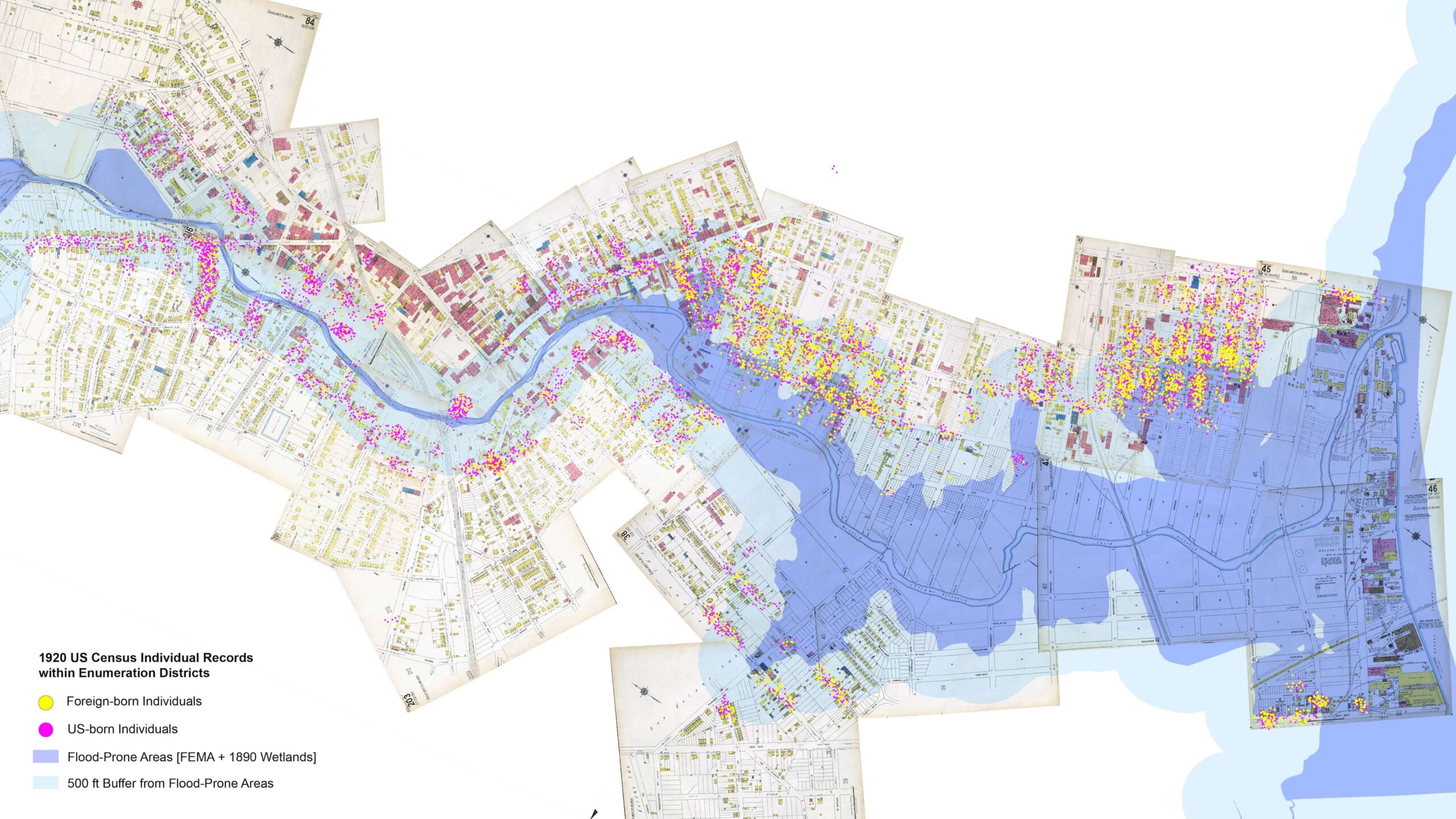
That gap mattered especially in places like Mattano Park, where the Olmsted Brothers saw a strong case for investment precisely because of the people living nearby. The firm classified Mattano among its “special Parks, although local in character, called for by considerations of either population or special natural conditions or both”.[4] As an extension of the proposed Elizabeth River Parkway, the site deserved, they wrote, “careful consideration for the number of people in the neighborhood that it would benefit”.[5] But who were those people? Our team at Rutgers University digitized and georeferenced the 1920 census line by line, producing more than 10,000 individual records for residents living along the Elizabeth River. The resulting maps reveal that the densely populated neighborhoods identified by the Olmsted Brothers were home to particularly high shares of foreign-born residents and workers in lower-wage industrial occupations [Fig. 4]. In that context, a well-designed neighborhood park was much more than simply an aesthetic amenity. It offered nearby access to green space for communities whose everyday lives were closely tied to the factories, infrastructure, and working waterfront of industrial Elizabeth.
How Recreation and the Turnpike Changed Mattano Park
Throughout the twentieth century, Mattano Park steadily departed from the landscape envisioned by the Olmsted Brothers. Two changes were especially consequential: the expansion of athletic fields beginning in the 1930s and, two decades later, the construction of the New Jersey Turnpike.
The first reflected a broader change in what urban parks were expected to provide. Across Union County, growing demand for sports and active recreation led the Olmsted Brothers and the Park Commission to revise earlier plans and devote more land to playing fields and other recreational uses. Edward Clark Whiting of the Olmsted Brothers observed that “active recreation is far more popular than it was thirty years ago,” linking the shift to “shorter hours of confining labor and longer hours of unrestricted leisure.” [6] At Mattano Park, this changing culture of recreation increasingly favored athletic fields and other active uses over portions of the planted landscape envisioned in the 1920s. The loss of tree cover also reflected changing ideas about how public parks should serve a working city [Fig. 5].
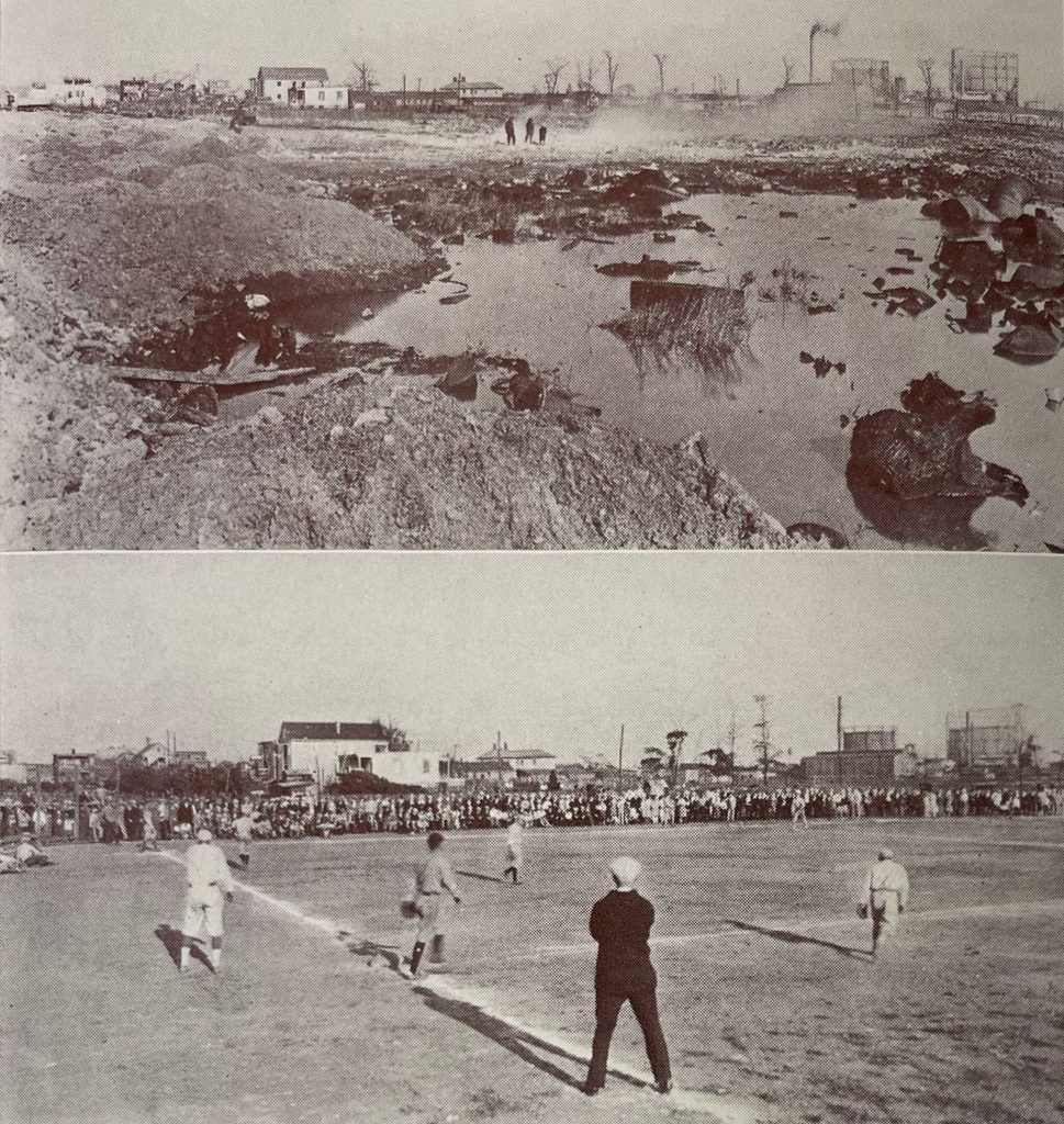
The Union County Park Commission, “Report of the Union County Park Commission, New Jersey, 1929-1930,” 10.
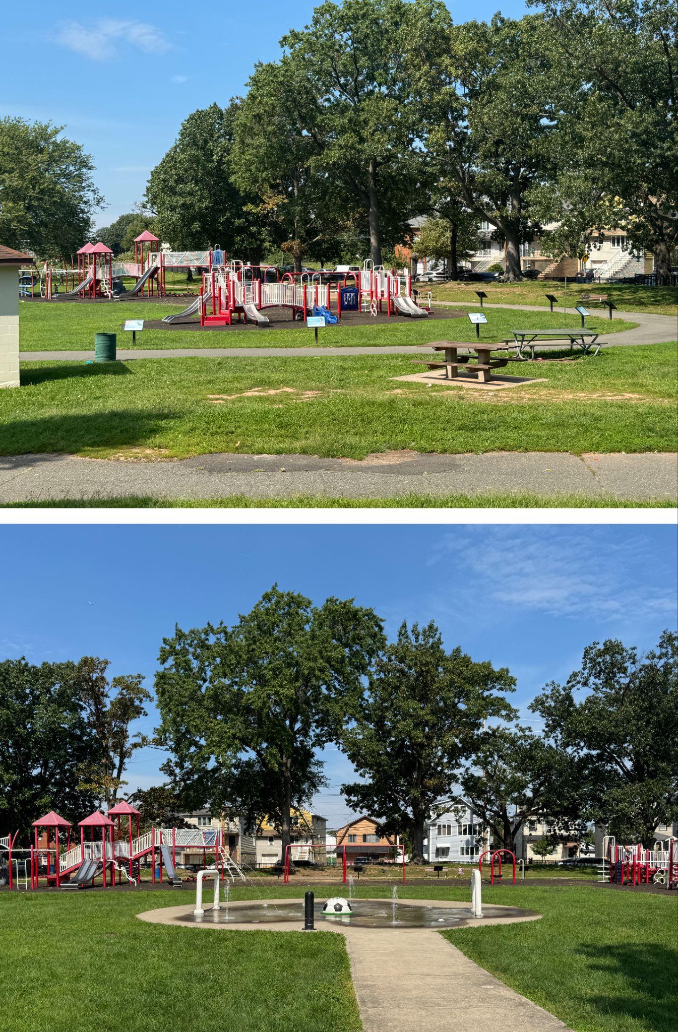
The growing popularity of active recreation was reflected in steadily rising attendance across the Union County park system, which drew nearly 14 million visitors in 1950, a milestone reported by The New York Times.[7] At Mattano Park, that success gradually shifted the balance of the landscape, with more space devoted to organized recreation. That legacy continues today. An April 2026 redesign updates the park’s athletic infrastructure, responding in part to Elizabeth’s changing recreational culture and the growing prominence of soccer over baseball, but it still leaves tree canopy limited. A similar shift can be seen in the children’s play area. The Park Commission’s 1930 report celebrated the completion of a wading pool; today, playgrounds occupy the footprint of the former pool, while a new, smaller splash pad has been built nearby. [Fig. 6]. Choices once made to expand recreational use now take on new significance under changing environmental conditions. With less canopy, fewer planted areas, and diminished water features, the park offers fewer opportunities for shade and cooling precisely as hotter summers make those functions increasingly important to the people using it.
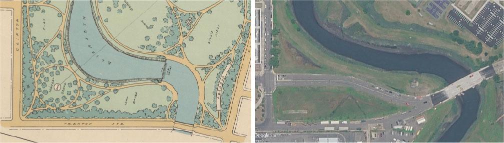
A far more disruptive intervention came with the New Jersey Turnpike in the early 1950s. Its construction rerouted Trenton Avenue closer to Mattano Park and cut into the boundaries of the original plan, effectively erasing much of the landscape envisioned for the park’s western side. A proposed “Concert Grove,” surrounded by dense tree cover, gave way to what is now Cole Place, a roadway carrying traffic between Interstate 95 and the surrounding street network [Fig. 7]. What remains are narrow fragments of green space with little room for the substantial tree canopy shown in the Olmsted drawings. Moreover, pedestrian crossings depicted in the Olmsted plans were never realized, and visitors attempting to move between the two sides today must leave the park and cross at Cole Place or another bridge designed primarily for cars.
The cumulative effects can be heard as much as they can be seen. Even before the Turnpike was built, the Olmsted plan used dense perimeter planting to create separation between Mattano Park and the urban growth the firm anticipated around it. Much of that vegetated buffer was never realized. Today, the park’s soundscape is shaped by the steady rush of Turnpike traffic, punctuated by horns and aircraft passing overhead. Near the former rose garden, where tree cover remains denser, that noise becomes noticeably less intrusive, and the surrounding infrastructure feels more distant. Elsewhere, with little vegetation separating the park from its surroundings, the sounds of traffic and aviation enter the landscape almost uninterrupted, alongside open views of an electrical substation, the Turnpike, and the industrial landscape beyond.
Building on the Olmsted Legacy for a Greener Elizabeth
The work of the Olmsted Brothers in Union County, especially along the Elizabeth River, long predated the term “nature-based solutions,” [8] but many of their proposals would be recognizable today under that label. They imagined a landscape that could accommodate flooding, improve the river’s condition, increase tree cover, and transform former farmland, salt marshes, and dumping grounds into connected public green space. Those goals were never fully realized. Yet the underlying principles — greater permeability, more canopy, healthier waterways, and landscapes capable of buffering environmental stress — remain strikingly current, and are now taking new forms through community-led initiatives.
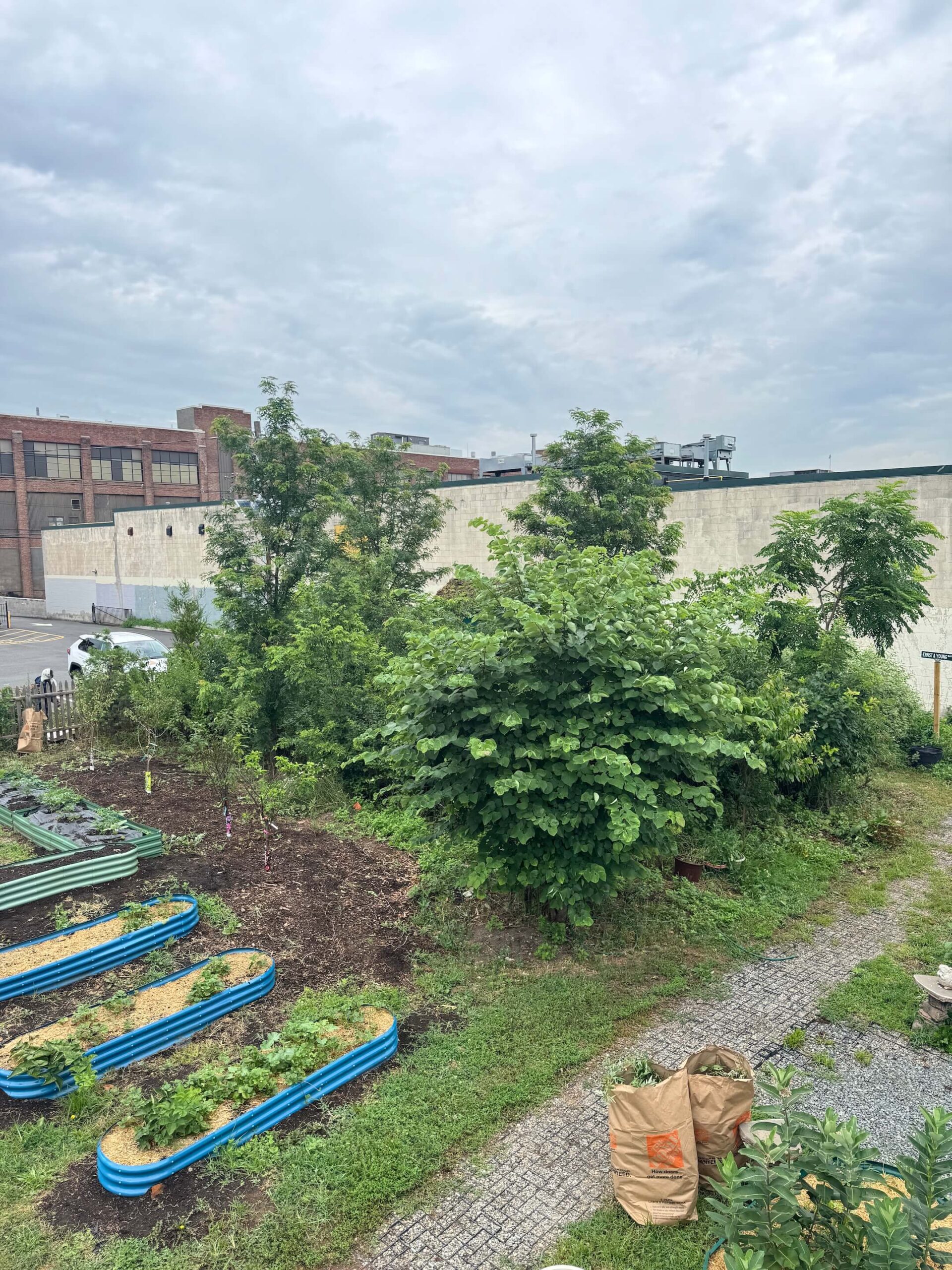
Since 2021, Groundwork Elizabeth has planted five “microforests” across the city using the Miyawaki method, which establishes dense, fast-growing, and highly biodiverse patches of woodland on relatively small areas of land [Fig. 8]. In Elizabeth, these projects have transformed heavily paved sites into concentrations of trees and improved soils. Groundwork reports that the microforests can be “50 degrees cooler than the asphalt in adjacent parking lots,” with soil “50 times more permeable than it was before.” [9]
A century after the first plans for Mattano Park, the environmental logic behind the Olmsted vision is reappearing at a smaller, more distributed scale. The canopy that never fully materialized in Mattano Park is taking new forms across Elizabeth, as scattered microforests return trees to paved and heat-exposed landscapes — not as a restoration of a century-old plan, but as a new infrastructure of shade, permeability, cooling, and repair.
______________
Dr. Carmelo Ignaccolo is Assistant Professor of Urban Planning and Design at Rutgers University’s Edward J. Bloustein School of Planning and Public Policy, where his research examines the intersections of urban design, climate resilience, and cultural heritage. His work has been supported by institutions including Harvard’s Dumbarton Oaks, the Fulbright Commission, and the New Jersey Historical Commission.
Acknowledgment: Archival research and historical analysis were conducted by Thomas Chambers (Rutgers Department of History), with additional support from Sharanya Sahu in GIS and urban analytics (Rutgers Bloustein School of Planning and Public Policy).
[1] Arthur R. Wendell (May 1935), “Esthetic Appeal of the Union County Park System,” in Olmsted Associates Records (p.41): Job Files, -1971; Files; 6957; Union County Park Commission; Elizabeth, N.J.; 1928 to 1939, 1949, 1955 to 1956. – 1939, 1928. Manuscript/Mixed Material. https://www.loc.gov/item/mss5257104534/.
[2] Jeanne Kolva (2011), Olmsted Parks in New Jersey, Schiffer Publishing, p.108.
[3] National Centers for Environmental Information, “Assessing the U.S. Temperature and Precipitation in July 2026,” National Oceanic and Atmospheric Administration, August 10, 2026.
[4] Olmsted Brothers, “Report on Union County Parks 1921,” July 5, 1921.
[5] Olmsted Brothers, “Report on Union County Parks 1921,” July 5, 1921.
[6] Edward Clark Whiting, “Some Observations Bearing Upon Warinanco Park,” February 13, 1934, 5.
[7] “Record Set in Jersey Parks,” The New York Times, January 23, 1950.
[8] Jared Green, “Olmsted Parks in the Era of Climate Change,” American Society of Landscape Architects, May 24, 2023, https://www.asla.org/news-insights/dirt/olmsted-climate-change-would-be-his-crucible.
[9] Sachi Kitajima Mulkey, “In New Jersey, Benefits Bloom in Tiny Forests,” The New York Times, July 22, 2025.